|
Herring Creek Bear Viewing, Ketchikan |


|
BACK TO WEBSITE |
|
NEXT PAGE |
|
NEXT PAGE |


|
BACK TO WEBSITE |
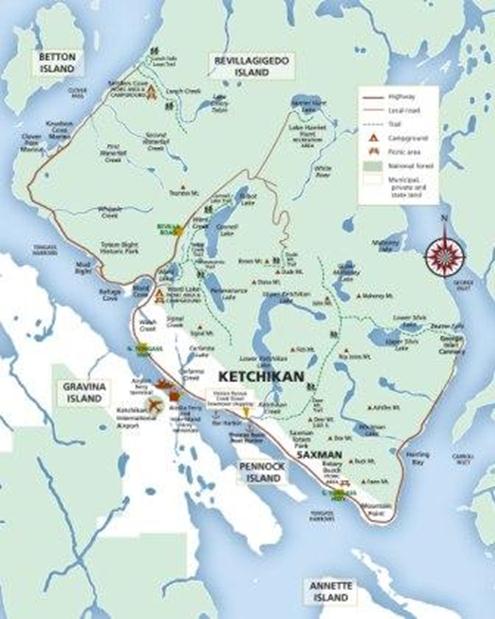
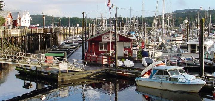
Ketchikan is located on Revillagigedo Island, which is an island because it is completely surrounded by Behm Canal in the Misty Fjords wilderness, and it has very few roads. From the center of town you can drive about 20 miles northwest or southeast on the paved road. There are a few other unpaved roads up into the interior. Our Tongass National Forest campground, Last Chance, was north on Revilla Road. It’s marked CAMPGROUND on the map to the left.Out the other direction is the Tlinget village of Saxman with native art and totems and a longhouse where they put on programs of native culture. If you continue past Saxman, around the point, you come to Herring Bay and Herring Creek. It’s marked on the map.On our “must do” list was a visit to the Ketchikan Yacht Club, pictured below. We have visited this club several times in the past when we docked here in Thomas Basin on our own boat, Four Seasons. We have always enjoyed the company of the folks here and they put on a spectacular hamburger feed on Friday nights.It was during this visit that we learned about Herring Creek. It seems you can just drive out there and park on the bank of the creek and watch the bears. For free. No airplanes, no hiking, no fees. So after dinner instead of going back to the campground, we drove out there. Some folks had seen a mama black bear with two cubs, and there was a report of a mama with THREE cubs. So we were really interested. |
|
CAMPGROUND |
|
HERRING CREEK |
Well, as it turned out, it took three evening visits to Herring Creek to finally see all of the bears. We did see mama + 2, and on the last night, at 8 PM just before we were going to leave, out came mama + 3!This was a parking area just off a dead end road with space for maybe 10 cars. Then you could stand on the bank above the creek in a space about 20 feet wide, shoulder to shoulder with about 15-20 other people, mostly locals. |
|
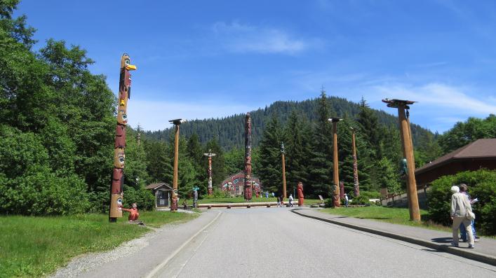
The Tlinget village of Saxman with the longhouse in the distance surrounded by totems. The visitor center is on the right. |
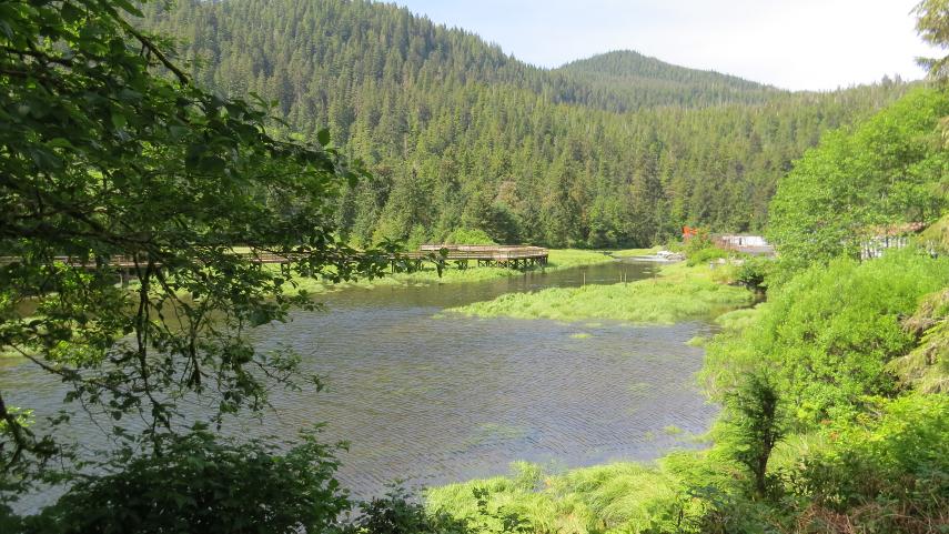
Below is Herring Creek just a few hundred yards upstream from where it empties into Herring Bay. There is a long wooden viewing platform on the opposite side of the creek, but it is privately owned and they charge $80 to use it and you must have a guide with you. We never saw anyone on it, but bears were constantly coming and going under it.There is a fish hatchery up the creek a little ways, so salmon return up the creek to near where they were spawned. They were returning in great numbers. This was mid-July. |
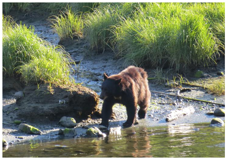
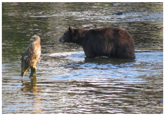
Above: a black bear (brown in color, but a black bear nonetheless) coming down to the creek to fish.Right: A juvenile eagle (you can tell by the mottled brown color) and a black bear sizing up the fishing prospects. |
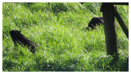
Below: two bears under the platform across the creek from us. |
|
NOTE: IF YOU ENTERED THIS PAGE FROM DAY66 OF THE TRIP LOG SECTION, CLICK HERE TO RETURN TO THAT PAGE. IF YOU ENTERED FROM THE FIRST PAGE OF THE WEBSITE CLICK ON BACK TO WEBSITE ARROW ABOVE. |